Eidolon
'/%3e%3cpath%20d='M556.663%20334L556.663%20296.891L593.772%20296.891L593.772%20259.782L630.891%20259.782L630.891%20222.663L668%20222.663L668%20185.554L668%20148.446L668%20111.337L630.891%20111.337L630.891%2074.2177L593.772%2074.2177L593.772%2037.1088L556.663%2037.1088L556.663%20-9.73336e-06L519.554%20-1.29775e-05L482.446%20-1.62217e-05L445.337%20-1.94658e-05L445.337%2037.1088L408.218%2037.1088L408.218%2074.2177L371.109%2074.2177L371.109%20111.337L334%20111.337L334%20222.663L371.109%20222.663L371.109%20259.782L408.218%20259.782L408.218%20296.891L445.337%20296.891L445.337%20334L556.663%20334Z'%20fill='url(%23paint1_linear_6772_63518)'/%3e%3cpath%20d='M779.337%200V37.1089H742.228V74.2177H705.109V111.337H668V148.446V185.554V222.663H705.109V259.782H742.228V296.891H779.337V334H816.446H853.554H890.663V296.891H927.782V259.782H964.891V222.663H1002V111.337H964.891V74.2177H927.782V37.1089H890.663V0H779.337Z'%20fill='url(%23paint2_linear_6772_63518)'/%3e%3cpath%20d='M1224.66%20334L1224.66%20296.891L1261.77%20296.891L1261.77%20259.782L1298.89%20259.782L1298.89%20222.663L1336%20222.663L1336%20185.554L1336%20148.446L1336%20111.337L1298.89%20111.337L1298.89%2074.2177L1261.77%2074.2177L1261.77%2037.1088L1224.66%2037.1088L1224.66%20-9.73336e-06L1187.55%20-1.29775e-05L1150.45%20-1.62217e-05L1113.34%20-1.94658e-05L1113.34%2037.1088L1076.22%2037.1088L1076.22%2074.2177L1039.11%2074.2177L1039.11%20111.337L1002%20111.337L1002%20222.663L1039.11%20222.663L1039.11%20259.782L1076.22%20259.782L1076.22%20296.891L1113.34%20296.891L1113.34%20334L1224.66%20334Z'%20fill='url(%23paint3_linear_6772_63518)'/%3e%3cdefs%3e%3clinearGradient%20id='paint0_linear_6772_63518'%20x1='59.0429'%20y1='52.1421'%20x2='296.224'%20y2='302.367'%20gradientUnits='userSpaceOnUse'%3e%3cstop%20stop-color='white'%20stop-opacity='0.4'/%3e%3cstop%20offset='1'%20stop-color='%23D9D9D9'%20stop-opacity='0'/%3e%3cstop%20offset='1'%20stop-color='white'%20stop-opacity='0'/%3e%3c/linearGradient%3e%3clinearGradient%20id='paint1_linear_6772_63518'%20x1='608.957'%20y1='281.858'%20x2='371.776'%20y2='31.6328'%20gradientUnits='userSpaceOnUse'%3e%3cstop%20stop-color='white'%20stop-opacity='0.4'/%3e%3cstop%20offset='1'%20stop-color='%23D9D9D9'%20stop-opacity='0'/%3e%3cstop%20offset='1'%20stop-color='white'%20stop-opacity='0'/%3e%3c/linearGradient%3e%3clinearGradient%20id='paint2_linear_6772_63518'%20x1='727.043'%20y1='52.1421'%20x2='964.224'%20y2='302.367'%20gradientUnits='userSpaceOnUse'%3e%3cstop%20stop-color='white'%20stop-opacity='0.4'/%3e%3cstop%20offset='1'%20stop-color='%23D9D9D9'%20stop-opacity='0'/%3e%3cstop%20offset='1'%20stop-color='white'%20stop-opacity='0'/%3e%3c/linearGradient%3e%3clinearGradient%20id='paint3_linear_6772_63518'%20x1='1276.96'%20y1='281.858'%20x2='1039.78'%20y2='31.6328'%20gradientUnits='userSpaceOnUse'%3e%3cstop%20stop-color='white'%20stop-opacity='0.4'/%3e%3cstop%20offset='1'%20stop-color='%23D9D9D9'%20stop-opacity='0'/%3e%3cstop%20offset='1'%20stop-color='white'%20stop-opacity='0'/%3e%3c/linearGradient%3e%3c/defs%3e%3c/svg%3e)
Services
Below are the services offered by the Eidolon Unit to students, teachers, researchers and businesses
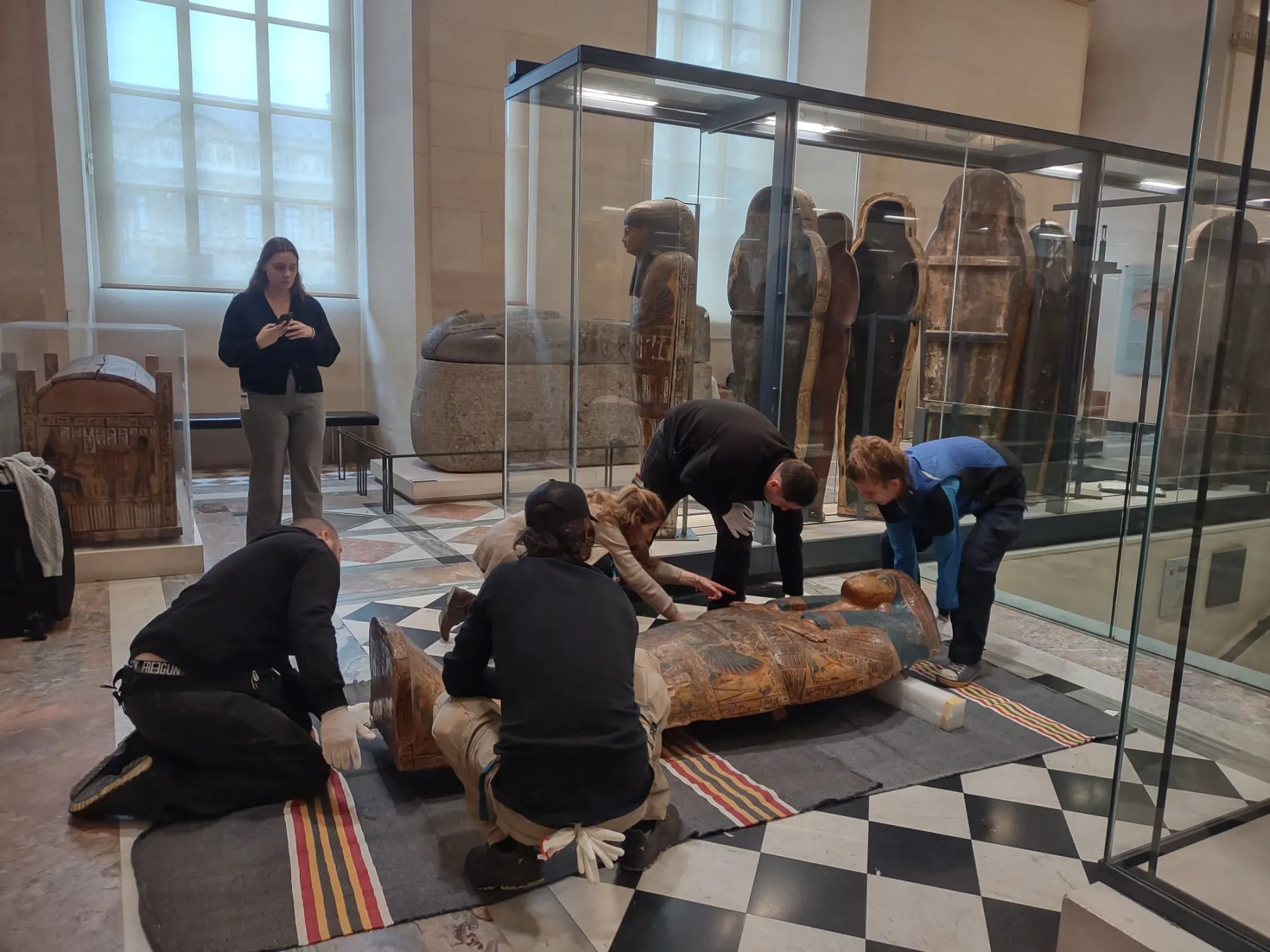
Analysis, processing and sharing of data relating to archaeological artefacts and environments
Analysis and analytical and graphical processing of data and creation of models of objects on various scales and for different purposes, sharing and communication of results to be delivered in a format that is accessible to a general audience.
Experimental integration of investigative techniques and methods in the field of archaeology
The study of new investigative techniques and methods that aim to resolve specific problems in the field of archaeology. Design and customisation of techniques to meet the demands of clients (museums).
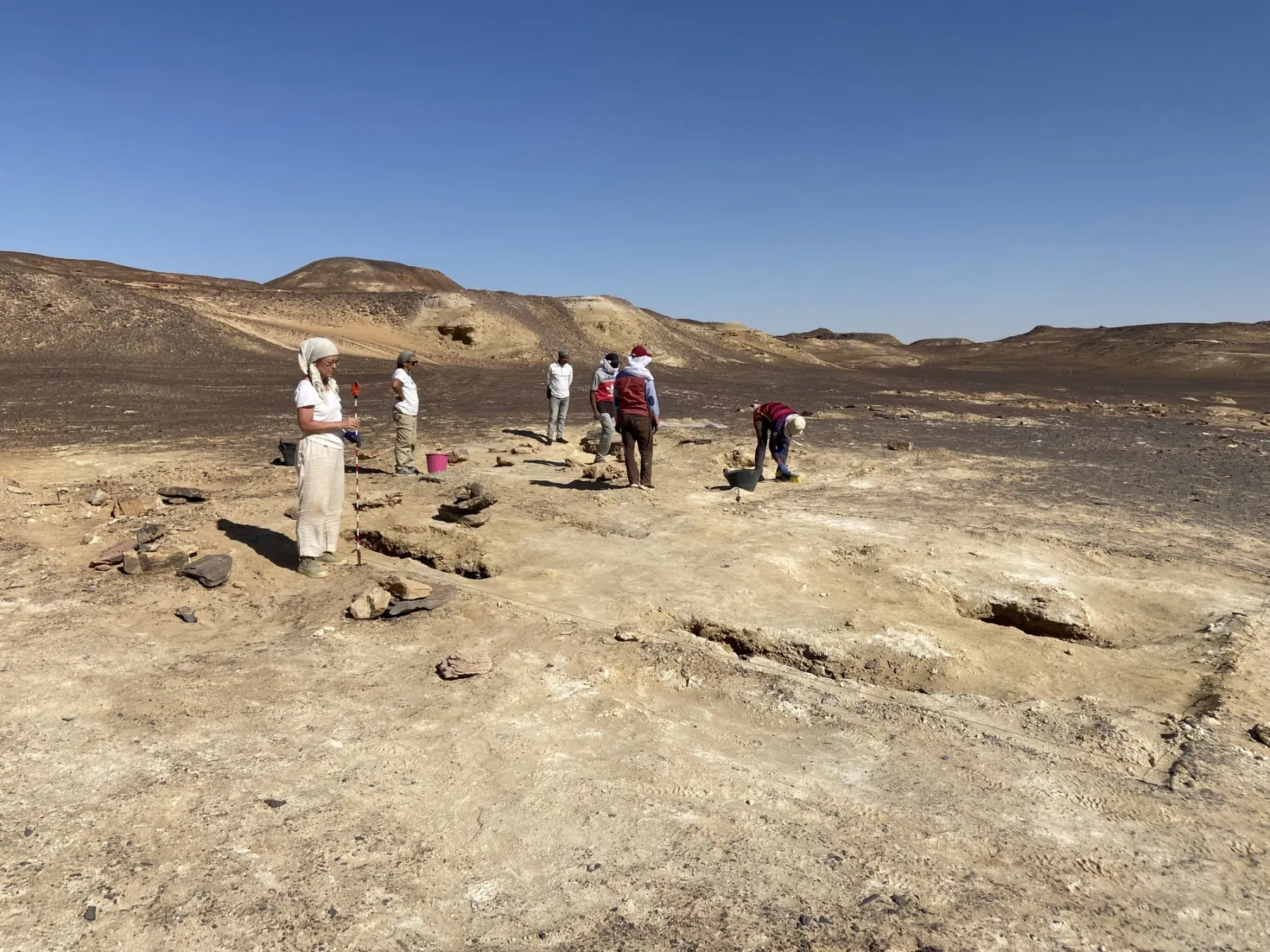
Photogrammetry and aerial photogrammetry
Aerial photogrammetry surveys using UAV technology. ground surveys of the land and the built environment and image processing.
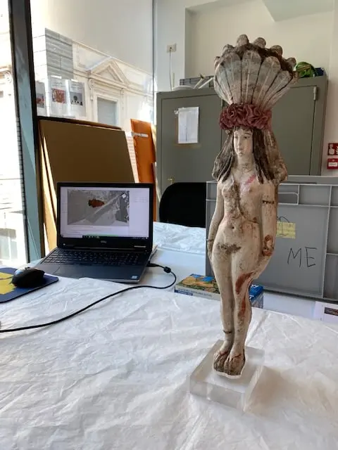
Scanner technology
Three-dimensional surveys through the use of LiDAR sensors, terrestrial laser scanners and structured-light 3D scanners of complex architecture, sites, archaeological digs, the environment and small-scale objects. Use of data obtained for the simulation of scenarios and environmental monitoring.
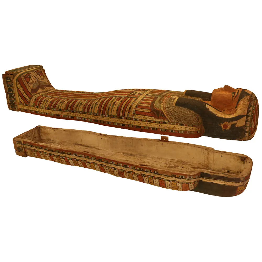
Two- and three-dimensional representation
Drafting of designs on all scales, representations of architecture through the creation of digital models and realistic simulations by means of specialist software.
Tools
Artec EVA
Find out moreDrone fleet
Find out more