New co-registration methods for COSMO-SkyMed data
2015
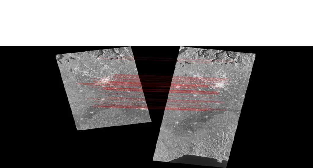
The aim of this work was to simplify the integration of standard SAR products with other georeferenced data for map applications (for example thematic classification, fusion of multi-sensor data or GIS analysis), by non-expert users in signal processing. For this reason, the methodology of automatic multi-image registration developed during the project “Subpixel methods for correspondence searches, image registration and change detection with applications for civil and environmental engineering” was adapted and optimised for SAR data for the purpose of improving the accuracy of the original geocode of radar images acquired with various geometric configurations.
This technique has proven to be effective in limiting co-registration errors and overcoming the limitations of classic image-matching algorithms due to occlusions, radar shadow, different polarisation of microwaves or different angles of view and orbit. Furthermore, it is a relatively new methodology for the remote sensing radar community and to date no commercial software uses this technique. The results show that multi-image registration can be applied with success to SAR images acquired from COSMO-SkyMed and Sentinel-1, without any specific knowledge of signal processing.
Overall, this study intends to meet the needs of typical users in geosciences who lack expertise in the processing of radar signals and want to use SAR images in their studies as supplementary information.