Hydrogeological modeling for erosion risk assessment from space (HERASE)
2017
The potential erosion of soil is considered to be one of the biggest threats in the European Union, with repercussions for ecosystem services, crop production, potable water and carbon stocks. Unfortunately, this issue is usually underestimated in local planning: recent estimates from the Ministry of the Environment (2013) indicate that €40 billion of investment is necessary to reduce the risk associated with soil loss in Italy.
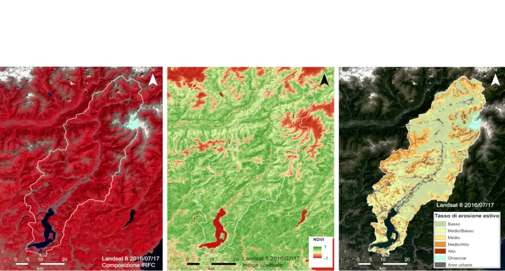
The purpose of the HERASE project is to develop an analysis methodology based on the Revised Universal Soil Loss Equation (RUSLE) model, which can be made dynamic by using multi-temporal land-cover maps obtained from multispectral indices acquired by satellite image processing at different scales (Landsat, ASTER, Sentinel-2,…), in order to identify the zones that are potentially subject to erosion phenomena and the dynamics of the changes in the land which are capable of impacting the whole. In situ erosion measurements carried out with rain simulators will make it possible to characterise the hydrology of representative zones and to calibrate the model. The model of potential land erosion will be supplied with climate data produced by weather stations, taking into consideration both liquid and solid precipitation. The loss of land will be calculated on a sub-hourly timescale and then rescaled to a seasonal scale, in order to obtain a final hydrogeological risk map linked to erosion. Lastly, the predictions provided by the weather models will be used to identify possible future risk scenarios, in an environment that sees mountainous areas, and alpine areas in particular, increasingly subject to climate changes.