Evaluation of COSMO-SkyMed system performances and simulation of future dual and bilateral system for earth observation ORFEO with existing optical data
2010
Project aims:
1 – To demonstrate the capability of COSMO-SkyMed in measuring ground deformation with millimetre precision.
2 – To evaluate the potential for a fusion of COSMO-SkyMed data and high-resolution optical images in anticipation of the future dual-use ORFEO system.
3 – To evaluate the performance of COSMO-SkyMed for coastal surveys.
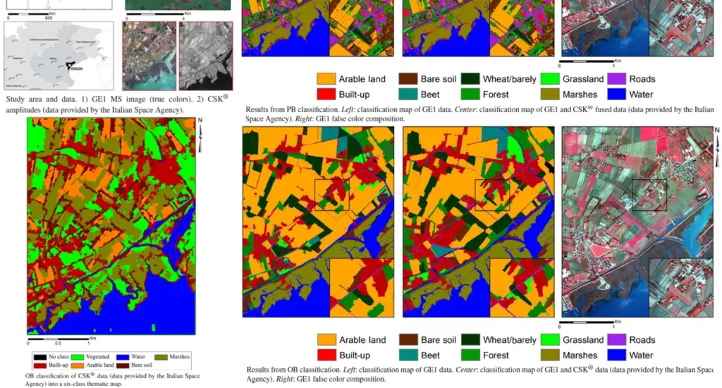
The project demonstrated the potential of the joint use of multispectral optical data and high-resolution geometric X-band SAR for the classification of land-cover/land-use, exploring both pixel-based and object-based techniques. A first thematic classification test with GeoEye-1, QuickBird and COSMO-SkyMed data was carried out in the coastal area surrounding the city of Venice, which was chosen for the presence of rich land-cover which is unlike any other.
The results obtained show how the integration of radar data with optical data can offer interesting possibilities in the field of thematic OBIA classification of land-cover/land-use, increasing the classification accuracy when compared to the use of crude multispectral data only, such as that of high-resolution geometric sensors.