Sustainable, social, economic and environmental revitalization in the historic core of Multan city
2012
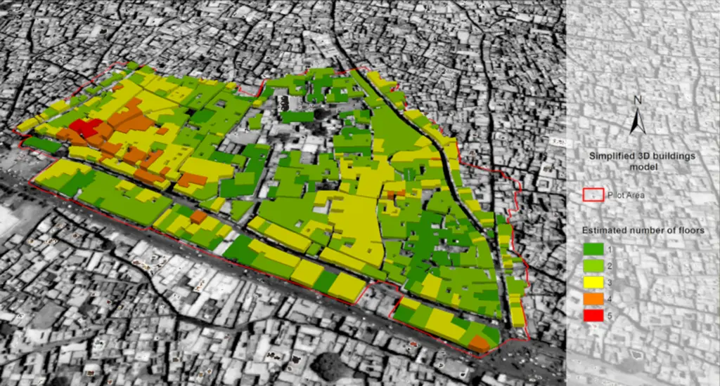
The aim of the project was to plan the architectural, urban and cultural redevelopment of a neighbourhood situated in the historic centre of the ancient city of Multan (Pakistan). The ultimate aim was therefore to improve the residents’ quality of life.
In this multidisciplinary setting, remote sensing activities have a dual role: providing updated cartographic support to the working group using high-resolution geometric satellite images; to study the dynamics of land-use changes (urbanised/green areas relationship).
The use of satellite Earth observation technology made it possible to overcome the constraints imposed by the authorities in relation to aerial imaging. Furthermore, the data captured from space provided a new interpretation of the dynamics of Multan as a complex city by its very nature.