Land Degradation Earth Observation assessment towards mitigation

Land Monitoring Decision Support System and bottom-up co-creation policies model. Digital Twin implementation (Basilicata Region)
A combined gis and remote sensing approach to monitoring land degradation in the context of climate change. Provide a regional digital twin tool to support bottom-up policies for the conservation of the landscape of the Mediterranean basin (Italy).
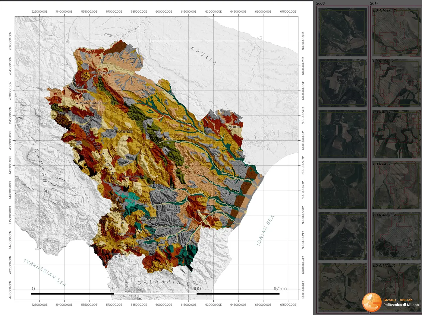
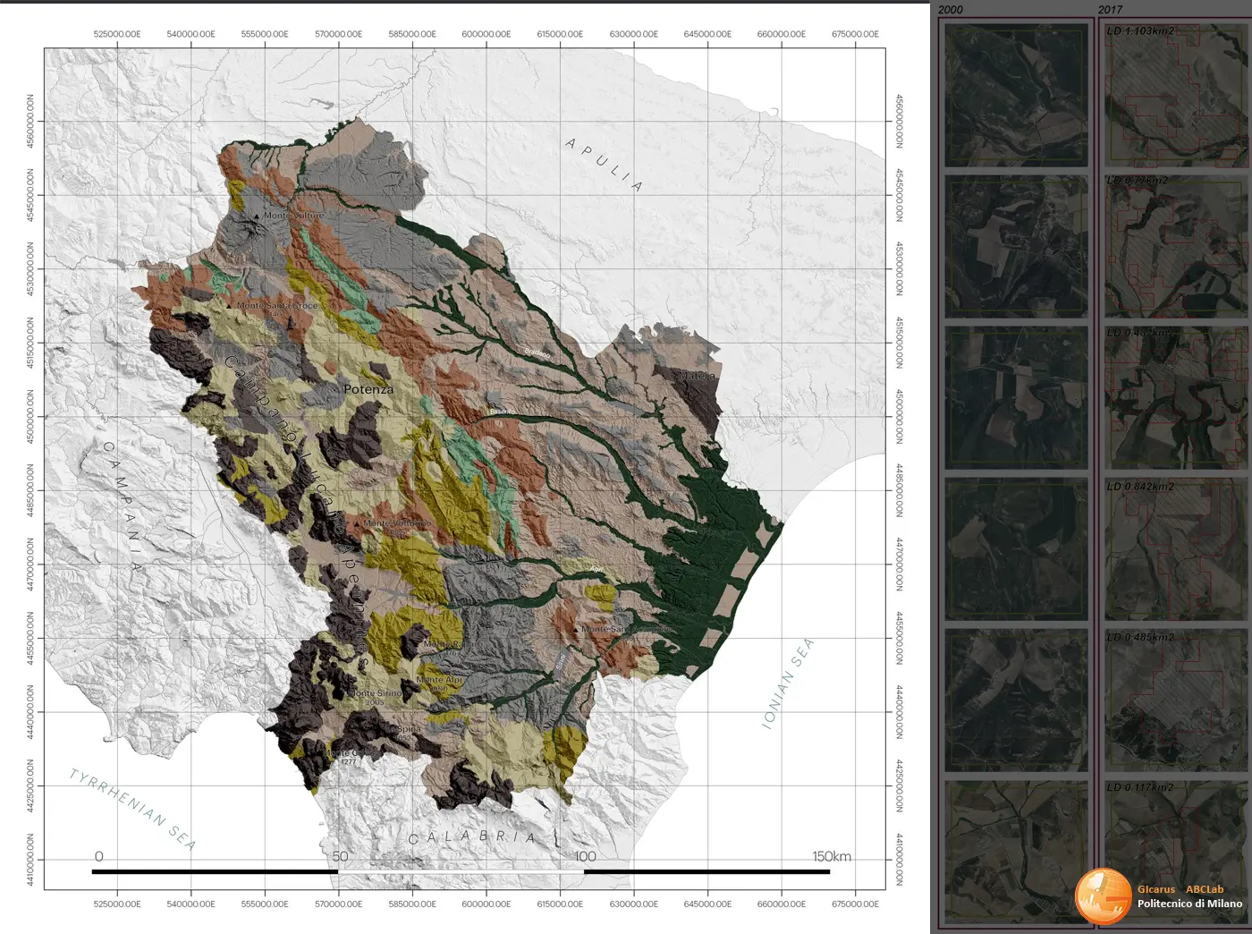
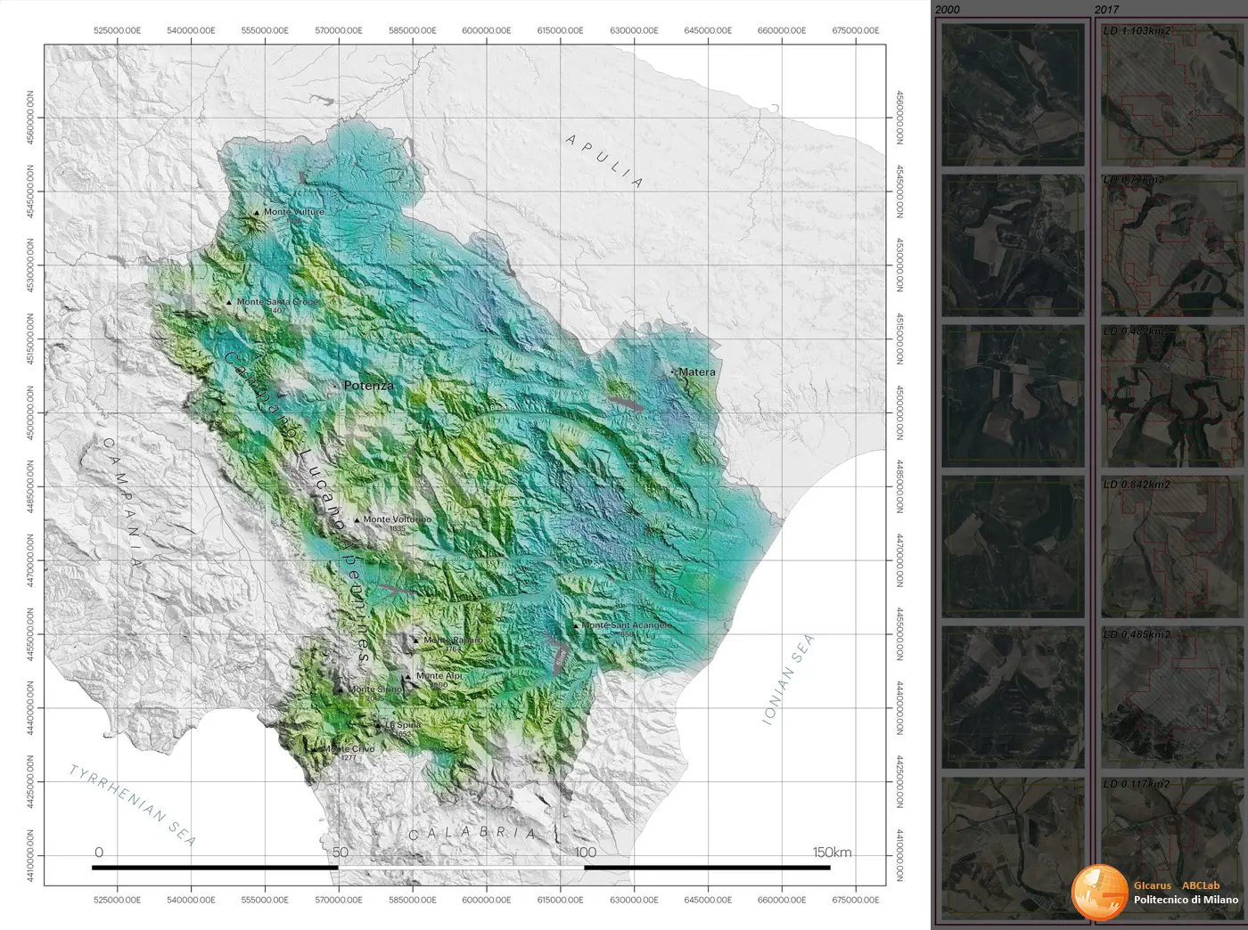
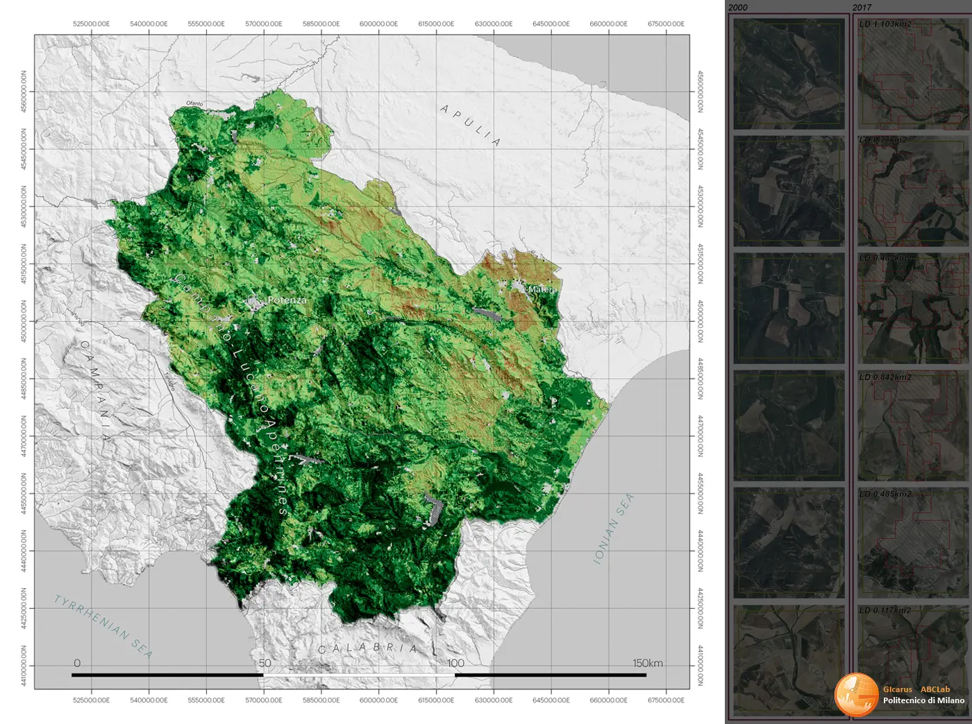
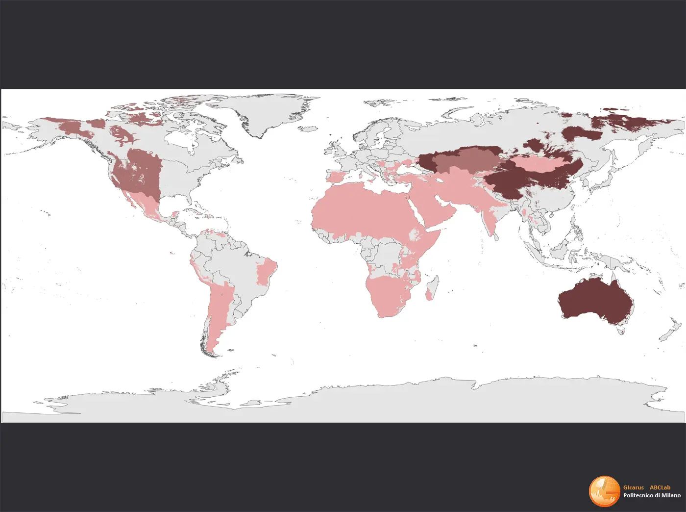
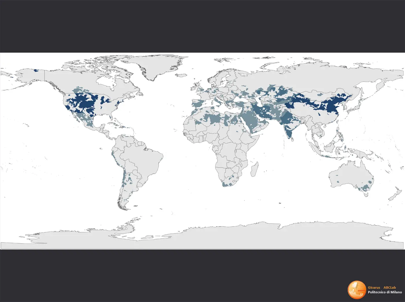
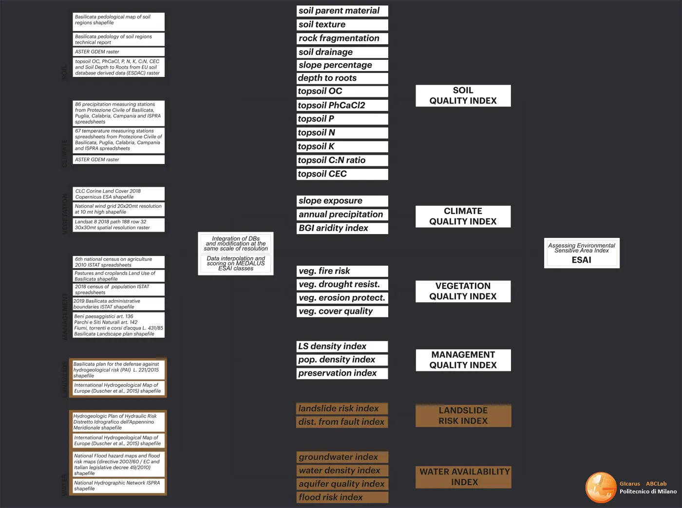
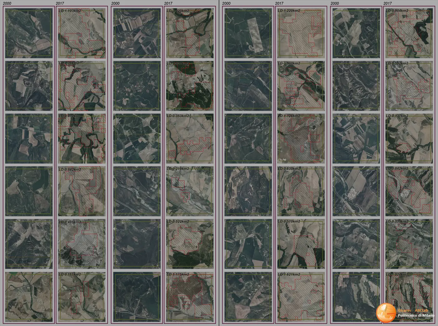
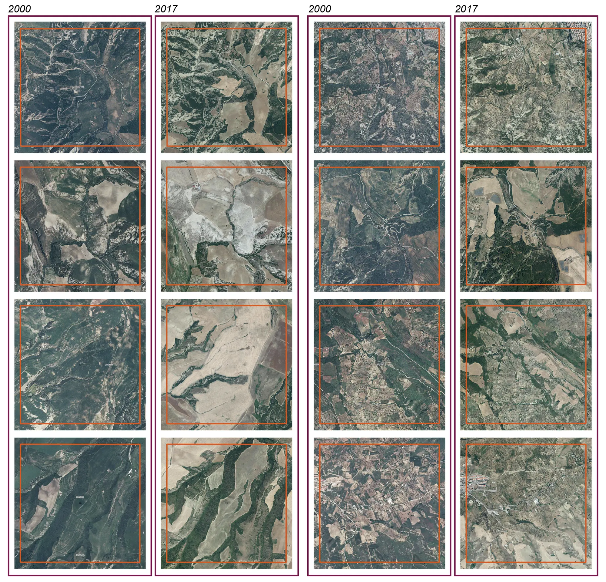
The research fits into the framework of the macro development objectives of the European Green Deal and the United Nation Sustainable Development Goals (SDG 14, Life on Land). The objective is to use new techniques and integrated methodologies in the field GIS (Geospatial Information System) and RS (Remote Sensing) applied to the study of land degradation phenomena (Land Degradation, LD) taking place in the Mediterranean basin of Europe, to implement a Digital Twin (DT) tool focused on the observation and monitoring of LD in predefined time thresholds (t0, t1, t2). The DT will allow the impacts of the LD to be documented in a dynamic way, innovating the landscape of territorial planning, providing a solid analytical database (multi-source and multi-dimensional) to support restoration and landscape conservation policies. The methodological integration of DT is conducted based on the MEDALUS (MEditerrean Desertification And Land Use) model, parameterizing the evaluation of LD indicators and sub-indicators in relation to the environmental and anthropic aspects of the studied areas (Basilicata, Puglia). The results obtained from the analysis are subsequently subjected to a ground validation cross-check, in order to test the goodness of the DT algorithm in the evaluation of the LD phenomenon.